Documenting underground assets
Undocumented or poorly documented underground utilities remain a hurdle for safe construction and long-term asset management. Traditional reliance on incomplete as-built records often leads to utility strikes and operational inefficiencies. As asset management evolves, institutions are increasingly adopting Geographic Information Systems (GIS) to manage spatial data in a standardized, centralized manner. However, the shift from manual data collection to GIS-compliant datasets requires precision, structured metadata, and integration from capture and processing into GIS software.
Why GIS compliance is important
For a dataset to be truly GIS-compliant within an engineering framework, it must meet specific quality standards:
- Georeferencing: data must be tied to accurate spatial coordinates within a global GNSS reference frame.
- Descriptive metadata: beyond physical location, the data must include attribute information regarding the asset’s characteristics.
- Integration: the format must allow for direct integration into GIS platforms to ensure data sharing across contractors and departments.
- Precision: documentation must meet legal or institutional standards to reduce the risk of utility strikes.
Achieving GIS compliance typically requires survey-grade tools, time-consuming workflows, or specialized skills. But with advances in mobile mapping and RTK positioning, it’s now possible to capture compliant data with a simple, handheld setup, including a smartphone.
Testing GIS-compliant utility mapping via smartphone with RTK
Pepperdine University in Los Angeles County, California, provides a “proof of concept” for the industry: testing whether digital documentation captured via smartphone with an RTK device can meet the strict legal and technical standards required for GIS compliance.
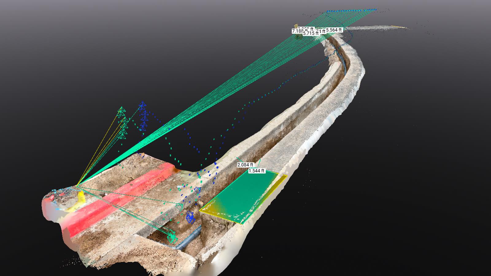
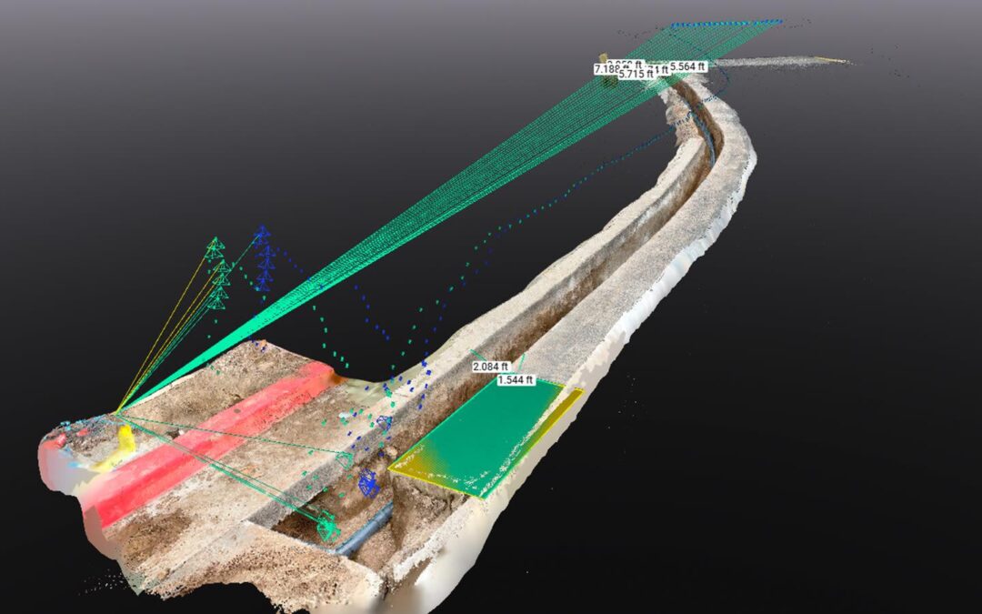
3D reconstruction of a utility trench captured with PIX4Dcatch and RTK, showing measured distances and camera positions used for photogrammetry
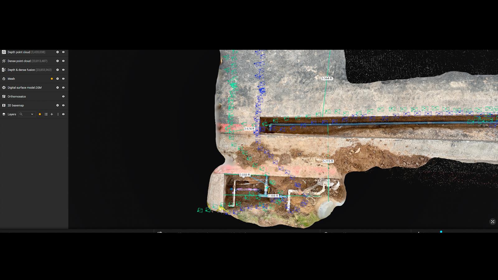 Top-down view of the project site in PIX4Dmatic, displaying the dense point cloud, image alignment, and measurement annotations of buried utilities
Led by Gabriel Armas, Asset Systems Development Manager, the team implemented this pilot to document critical subsurface utilities, specifically irrigation and water lines, and ensure every asset is accurately georeferenced during the window of active maintenance and new construction.
Technical workflow & methodology
The team used a setup consisting of an iPhone 15 Pro Max paired with the PIX4Dcatch application and an RTK-enabled GNSS receiver.
The workflow followed a four-stage process:
- Field capture: capturing high-resolution imagery and LiDAR data of open utility trenches using the smartphone app with an RTK device for accuracy.
- Processing: Using PIX4Dmatic for reconstruction and dense point cloud generation.
- GIS integration: the outputs were imported into QGIS to align the newly documented assets with existing site features and campus basemaps.
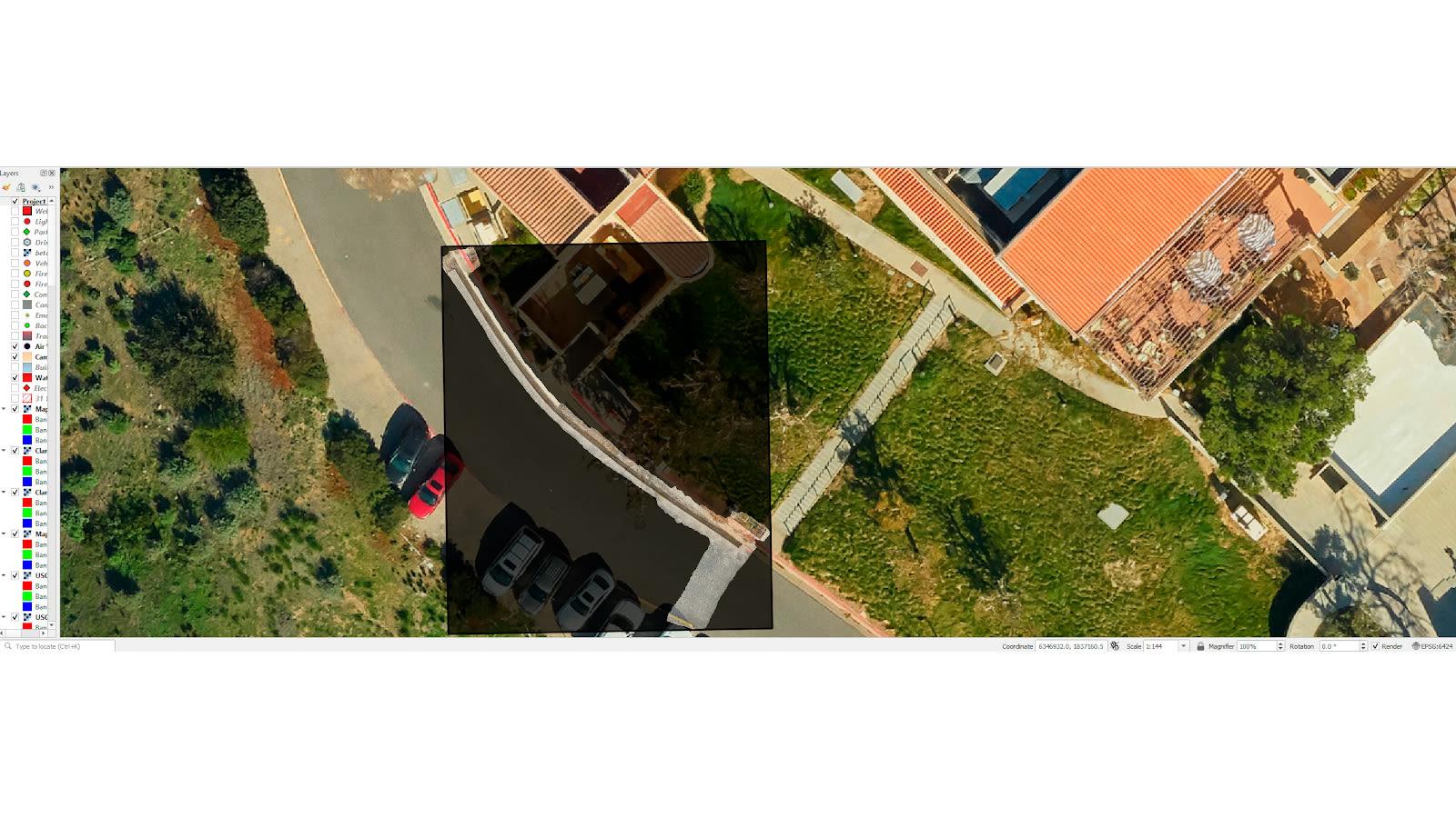 Overlay of the processed utility trench model on a QGIS basemap for geospatial context and alignment with existing site features
Efficiency and regulatory compliance
The pilot project demonstrated that high-fidelity 2D and 3D subsurface data could be collected and processed in a fraction of the time required by traditional surveying methods.
- Time savings: the entire process, from data collection to the production of a final printed map, was completed in approximately 6 hours, with an additional hour to produce a final printed map.
- Regulatory alignment: In jurisdictions such as California, where GIS shapefiles are mandated for newly discovered or installed utilities, this workflow ensures that contractors and engineers remain fully compliant with local standards.
The goal was to test the ability to map a newly installed utility, and the team succeeded—producing a GIS-compliant dataset suitable for long-term use. By eliminating the “as-built information gap”, organizations can significantly mitigate future risks.
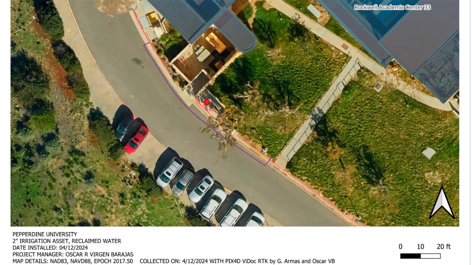
Final printed map showing the documented irrigation line at Pepperdine University, complete with asset details, coordinates, and collection metadata for compliance and archival
A large-scale infrastructure case study
While using a smartphone with an RTK device to document assets can meet legal GIS standards, the practical challenge for many subsurface utility engineering (SUE) professionals is maintaining that accuracy over time and across vast project areas.
Maintaining situational awareness at scale
In Justice, Illinois, a major roadway construction project spanning over 300 acres, intersected by a primary interstate, presented significant logistical hurdles. The scale of the site and the sporadic nature of the construction schedule meant that traditional physical utility markings were constantly being worn away by weather and heavy machinery.
For the city and the contractors involved, poor decisions made due to a lack of real-time data can lead to catastrophic utility strikes and project delays. We spoke with Brian Layhew, a geospatial mapping specialist.
Integrating ground and aerial data
To maintain a persistent record, Layhew integrated aerial photogrammetry with ground-level scans:
- Aerial mapping: A Matrice 350RTK drone to create an expansive orthomosaic of the 300-acre site.
- Terrestrial capture: For high-stakes subsurface assets, an iPhone 15 Pro Max paired with PIX4Dcatch and an RTK rover was used to scan open holes and exposed pipes, providing an “astounding digital twin” of the underground infrastructure. With 1447 images captured in total.
- Orthomosaic: 7000 images were captured for the entire map
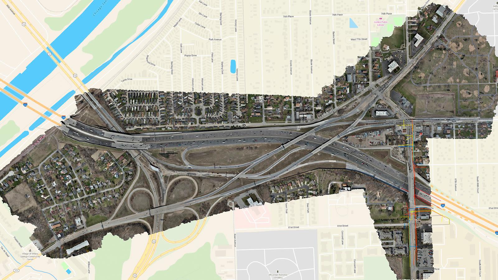
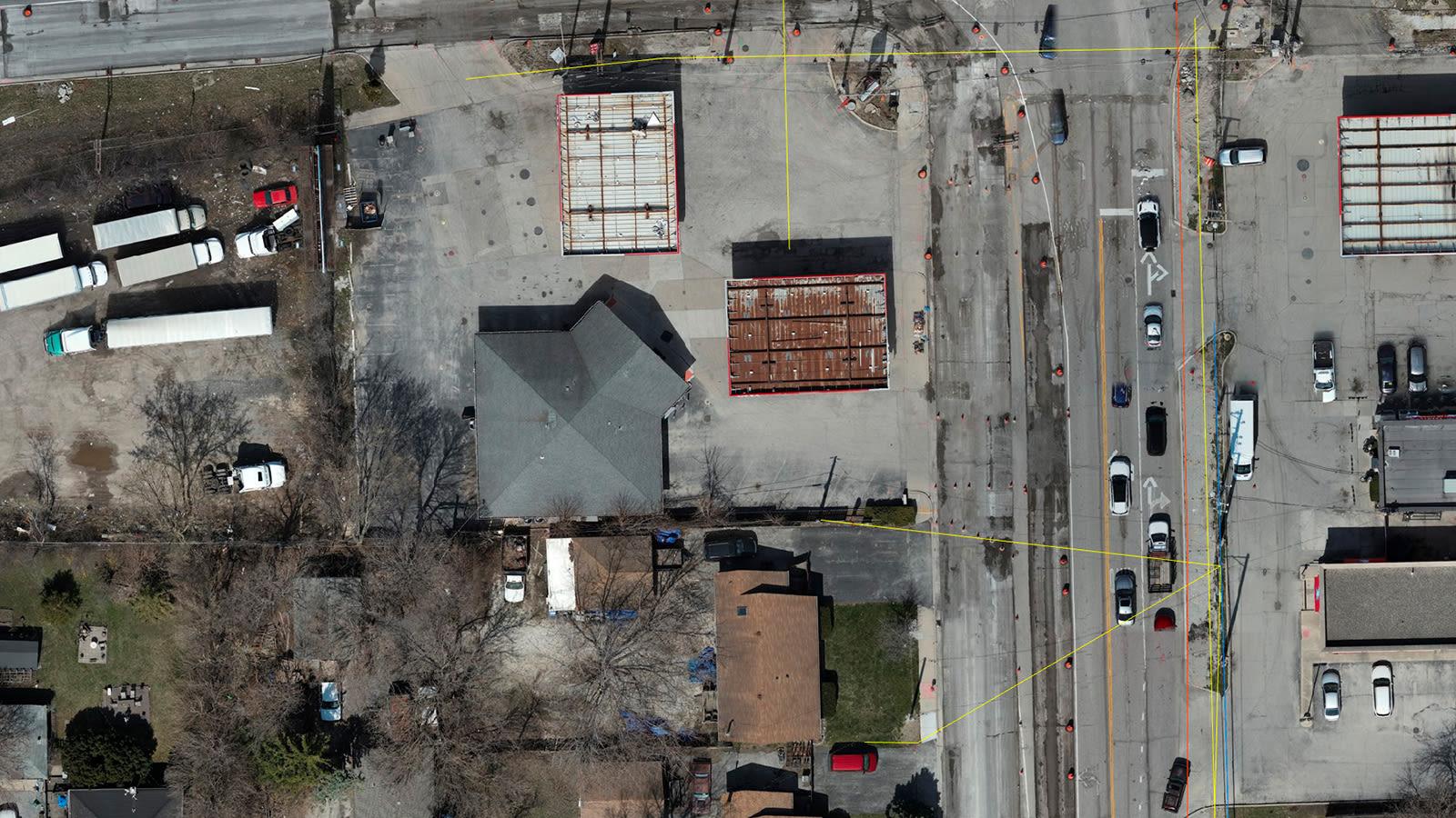
The project orthomosaic, captured with a Matrice 350RTK, was processed in PIX4Dmatic and imported to PIX4Dcloud to overlay design files. Zooming up on the orthomosaic in PIX4Dcloud shows the high resolution and detail of the map; the lines represent DXF files of reworked utilities
This ground-level data was then integrated into PIX4Dcloud, allowing office-based engineers to overlay design files (DXF) directly onto the high-resolution maps to verify utility locations against engineering schematics.
Field verification with augmented reality (AR)
Because the project is so large and slow-moving at times, utility markings were constantly being worn away. For example, the team needed to find an underground water main, and having a digital map of its exact location to be re-marked regularly was invaluable.
Because the digital documentation was GIS-compliant and accurately tied to the global GNSS reference frame, Layhew could use PIX4Dcatch’s AR features to “see” the water main through the earth as he walked the site.
This allowed for re-marking the utility with extreme accuracy even after the physical flags had disappeared. This capability transformed the GIS record from a static office document into a dynamic field tool, significantly reducing the risk of accidental damage during excavation.
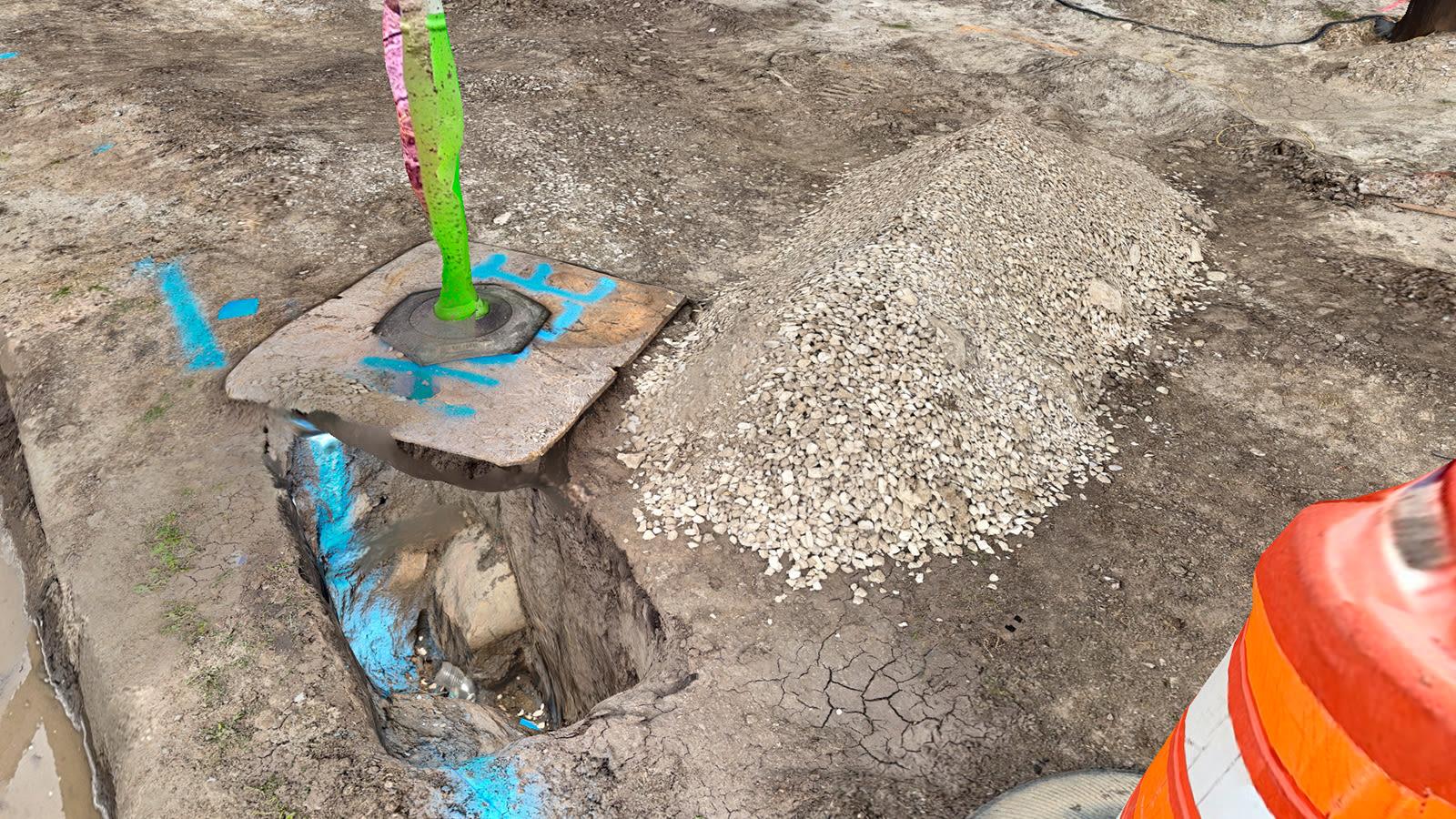
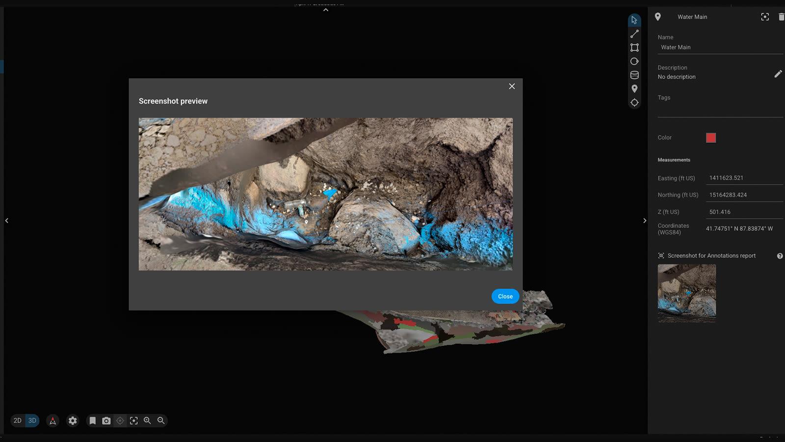
The water main was captured with PIX4Dcatch as seen in the top image. Brian was then able to add an image of this point of interest right from the field in the Pix4D mobile-to-cloud workflow. The water main was captured with PIX4Dcatch and immediately displayed in PIX4Dcloud as an annotation for personnel at the office or future reference
Beyond simple monitoring, using PIX4Dcatch, Brian integrated engineering DXF files into his models, using the app’s AR features to verify and update both project schematics and city utility records in real time.His main challenge was ensuring full coverage of the remote site, two hours from the office, with a smartphone. To avoid revisits, he captured extra images from multiple angles, ensuring completeness on the first attempt.
The findings from both the Pepperdine University pilot and the Illinois infrastructure project highlight the successful integration of smartphone capture with professional GIS standards. By validating that smartphone-based RTK documentation meets the data integrity and georeferencing requirements for GIS compliance, these cases prove that digital twins are no longer restricted to specialized survey crews.