
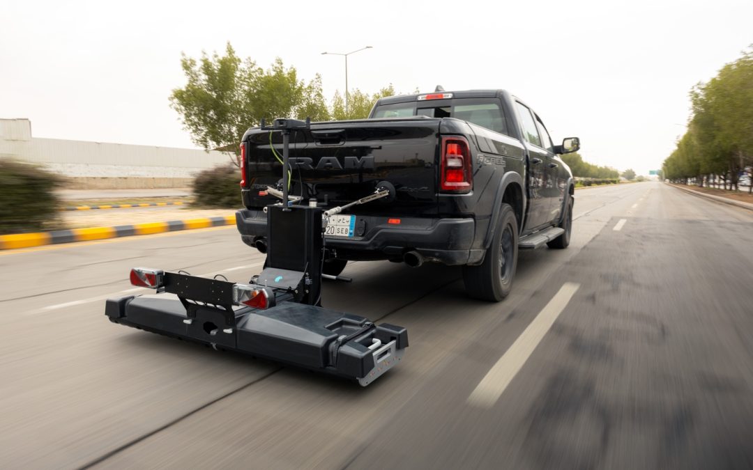
Latest generation multichannel GPR (MCGPR) as a new baseline for large-scale utility mapping leveraging on real-time 3D imaging, uninterrupted positioning in GNSS-challenged environments, and a cloud workflow built for distributed SUE teams.
By Dan Broekhove & Alex Novo
Beneath every street sits a dense, layered network of water, gas, sewer, power and telecom lines. Before anyone excavates, that network has to be found, because striking a live utility means safety incidents, service outages and blown schedules. The catch is that records for assets installed decades ago are often missing, outdated or simply wrong, so a desk study is only ever a starting point. Field investigation is where certainty is earned.
Ground penetrating radar (GPR) has become a mainstay of that field work: it is non-destructive, it detects metallic and non-metallic targets alike, it images trenches, voids and changes in backfill, and, unlike point tools, it returns continuous subsurface coverage. Its limits are real (clay-rich, highly conductive soils attenuate the signal), but for most surveys it remains the workhorse. For large jobs the question has never been whether to use GPR, but how to cover more ground, faster, without trading away confidence.
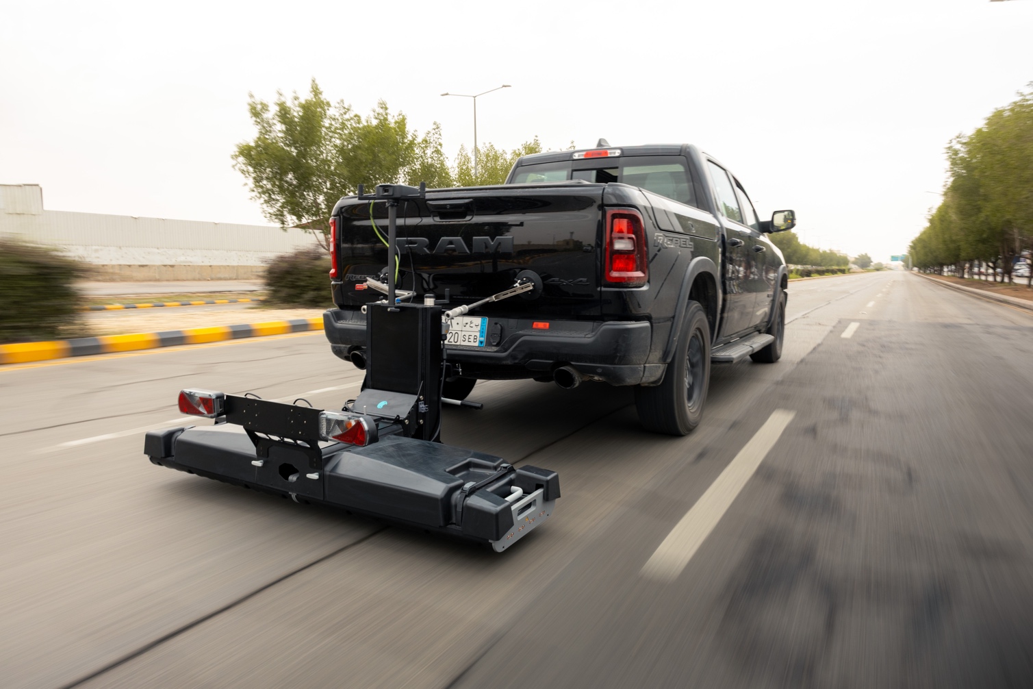
Figure 1. The GM8000 stepped-frequency MCGPR array, shown towed behind a survey vehicle. The same modular array also runs in a push-cart configuration for footpaths and constrained sites.
From a single line to a rolling 3D picture
That is exactly what multichannel GPR (MCGPR) changes. The GM8000 is a modular, stepped-frequency continuous-wave (SFCW) array. In its utility configuration it captures 23 channels across a 1.67 m swath in a single pass, at road speed rather than walking pace. In practice, a large intersection or a multi-lane corridor is covered in a handful of passes instead of dozens of hand-pushed lines. Densely spaced channels mean better target continuity between lines and far less interpolation. The guesswork that erodes confidence when parallel single-channel profiles are stitched together. Fewer passes also means less time exposed in live traffic, which is its own safety dividend.
The platform is deliberately modular: the array towed behind a vehicle for open corridors and intersections or deployed in a push-cart configuration for constrained sites. One data model, one workflow, whatever the site demands.
Seeing the answer while you are still on site
The bigger shift is that the operator no longer drives blind and hopes. The GM8000 renders a georeferenced 3D view of the subsurface live, laid directly over satellite imagery and, critically, over the client’s own CAD / GIS as-built layers. Linear features line up (or do not) against the record drawing in real time. Coverage gaps, missed lines and obvious mismatches with the as-built are caught on the spot, not three weeks later at a desk. That in-field verification loop is where revisits and re-mobilizations quietly disappear from a project’s cost.
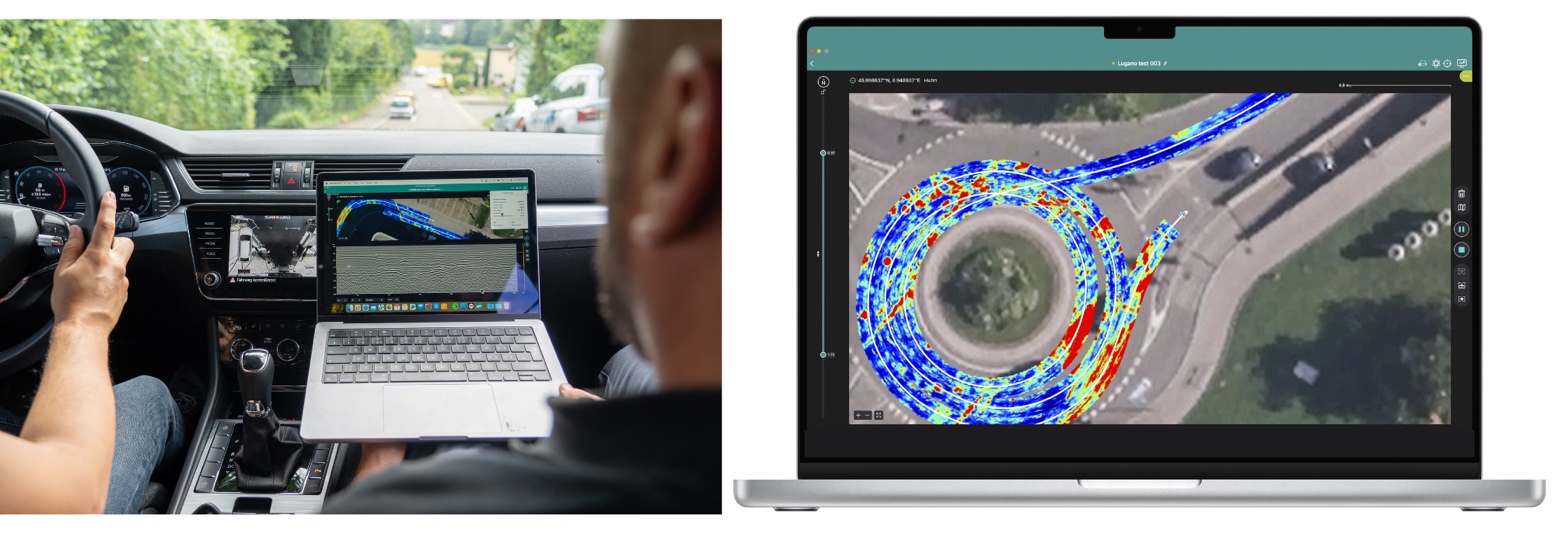
Figure 2. Georeferenced MCGPR data rendered live over aerial imagery during an urban survey. A white trajectory indicates a fixed RTK position; operators verify coverage against satellite and CAD / GIS as-built layers while still on site.
Positioning where GNSS gives up
Dense urban mapping is where positioning usually breaks down: tree canopy, tall buildings and underpasses drop the satellite fix exactly where utilities are densest. The GM8000’s Visual Inertial Positioning System (VIPS) is built for that. It fuses dual-antenna RTK GNSS with an IMU, wheel odometry and camera-based visual odometry “deep fusion” to hold a centimetre-grade trajectory through outages. Where a GNSS-degraded section is anchored by a fixed RTK position before and after it, the cloud automatically bundle-adjusts that segment back into place on upload. Positioning errors during limited-signal outages are held to roughly 0.1% of distance travelled (about 0.3m worst case).
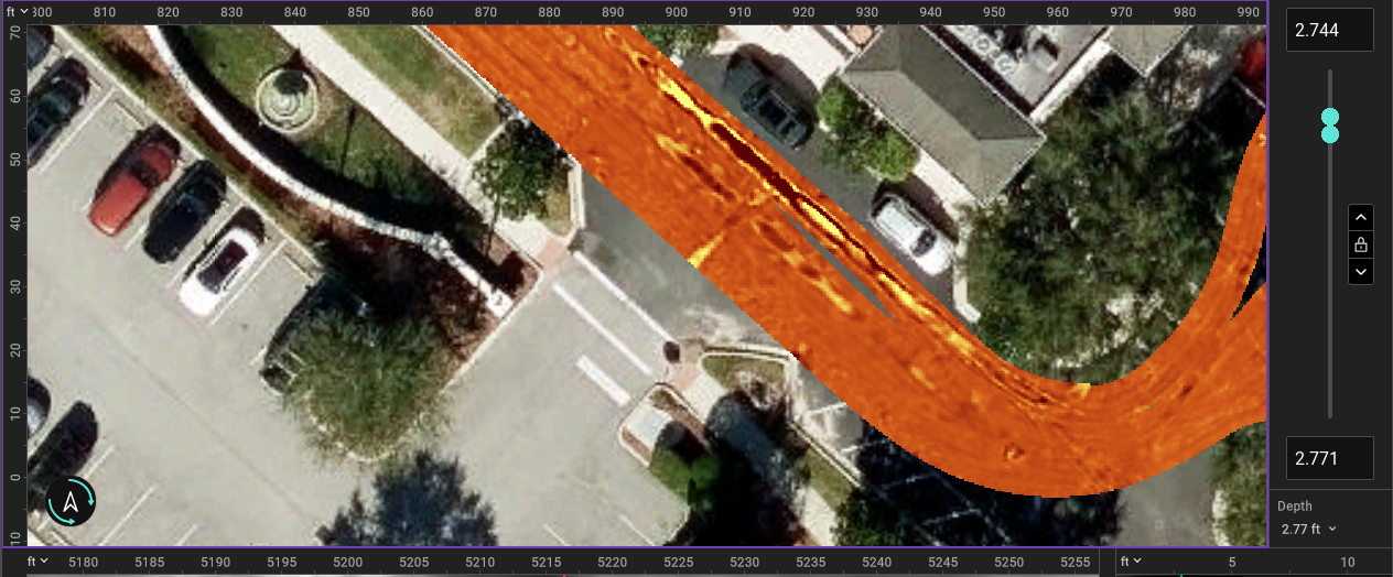
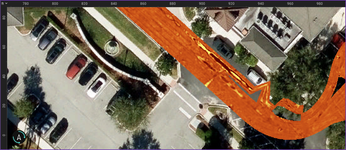 Figure 3. Positioning through GNSS degradation. Top to bottom: a GNSS-only trajectory drifts; real-time deep fusion (VIPS) holds the line; cloud bundle-adjustment refines the final trajectory after upload. Example of trajectory correction,(top image without and bottom image with).
One dataset, many desks
Field data syncs automatically to the cloud (Screening Eagle Workspace), where it is stored and processed, making it available to whoever needs it, wherever they are. A crew in the field, an interpreter in another city and a QA / QC reviewer can all work on the same dataset instead of emailing project files, or mailing hard disks, back and forth. For firms running distributed teams, that turns interpretation and independent review into a parallel, auditable process rather than a serial bottleneck.
Figure 5. Multichannel data with utilities drawn in 3D 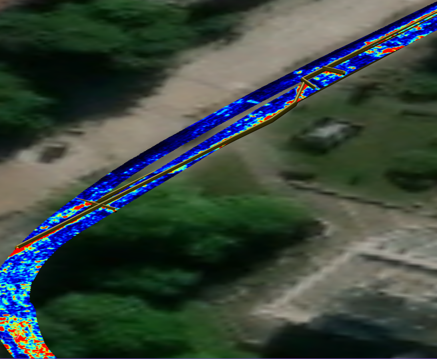 for clear analysis
Where it lands in ASCE 38-22
For SUE practitioners the relevant question is always: which quality level, and can you defend it? Under ASCE / UESI / CI 38-22, the current Standard Guideline for Investigating and Documenting Existing Utilities, surface geophysical designating sits at QL-B, the minimum grade for design decisions and the tier that GPR and electromagnetic locating are built to serve. Dense, continuous MCGPR coverage strengthens the QL-B layer and, just as importantly, documents the basis for every depicted line including the raw radargram, the trajectory, and the processing so the achieved quality level is traceable, not merely asserted. Better QL-B coverage also sharpens where scarce, expensive QL-A test holes actually need to go, concentrating vacuum excavation on genuine conflicts rather than scattering it on guesses.
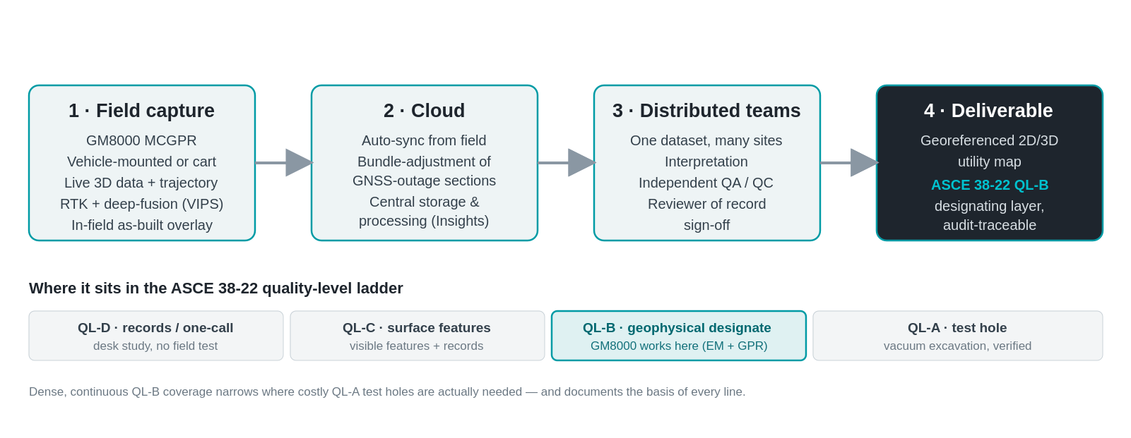
Figure 4. One field dataset flows to the cloud, where distributed teams interpret and independently QA / QC it, producing a traceable QL-B designating layer under ASCE 38-22.
What it means for SUE
The economics of SUE have never really been in dispute. Independent studies going back to the landmark 1999 FHWA-funded work have put returns on the order of several dollars saved for every dollar invested, driven by avoided damage, fewer relocations and shorter schedules. What MCGPR adds is throughput and confidence at the same time. More coverage per shift, denser data, real-time verification and defensible positioning, all feeding a cloud record the whole team can stand behind. For an industry whose core promise is “know before you dig,” that is a meaningful move of the baseline.
About author:
 Dr. Alexandre Novo is SVP Head BU Subsurface Insights GPR with 20+ years of international experience leading innovation, strategy, and commercialization of advanced sensing and geospatial technologies. Expert in Ground Penetrating Radar (GPR), digital products, AI-enabled workflows, and subsurface infrastructure solutions, with a strong track record of translating research into commercially successful products.
 Dan Broekhove is the GPR Business Development Manager for the Americas at Screening Eagle Technologies, specializing in Ground Penetrating Radar (GPR), subsurface utility mapping, and advanced non-destructive testing technologies. With more than a decade of experience in the geophysical and infrastructure industries, Dan works closely with engineering firms, utility locating companies, contractors, and municipalities to implement GPR solutions for locating and mapping underground utilities and infrastructure.