By Alberto Florez
How 3D mapping of underground infrastructure is key to efficiency, safety, and sustainability in urban project development
Beneath the asphalt of our bustling cities lies an invisible metropolis: an incredibly complex network of pipes, cables, and conduits supplying water, gas, electricity, and data, and managing our waste.
This underground labyrinth is the circulatory system of modern urban life. However, in much of Latin America, we operate almost blindly regarding this hidden world. The “utility cadastre” (the detailed record of this infrastructure) is often inaccurate, obsolete, or simply nonexistent. This lack of vision is one of the biggest obstacles to developing smart, safe, and sustainable cities.
Every time new construction begins or a road is repaired, a dangerous and costly lottery is unleashed. What lies beneath? At what depth? In what condition is it? The inability to answer these questions with certainty generates cost overruns, delays, safety risks, and negative environmental impact.
Today, a technological revolution is bringing this hidden city to light. 3D mapping of underground infrastructure, combined with intelligent models, is becoming the indispensable tool for building the cities of the future, starting from their invisible foundations.
The Challenge: Accelerated Urban Growth on Unknown Foundations
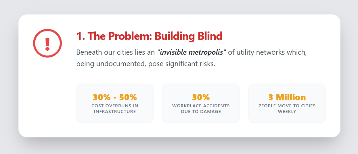
The driver of this problem is massive urbanization. Global migration toward urban centers is relentless. According to Google Earth data, three million people move to cities every week, and in the last 35 years, the world population has increased by more than 2.3 billion people. This explosive growth exerts immense pressure on existing infrastructure and demands constant expansion.
In developing countries, this growth often exceeds planning capacity. The lack of a precise utility cadastre means that the information engineers and builders have is, at best, an approximation. Existing plans are usually two-dimensional, without precise georeferencing and without crucial data such as network depth. This insufficient information turns every excavation into a risk.
The result is a vicious cycle of inefficiency: projects are delayed by unforeseen damage to networks, costs skyrocket, the community suffers from prolonged road closures, and the environment is affected by leaks and spills.
The Technological Solution: Seeing Through the Subsurface with 3D Mapping
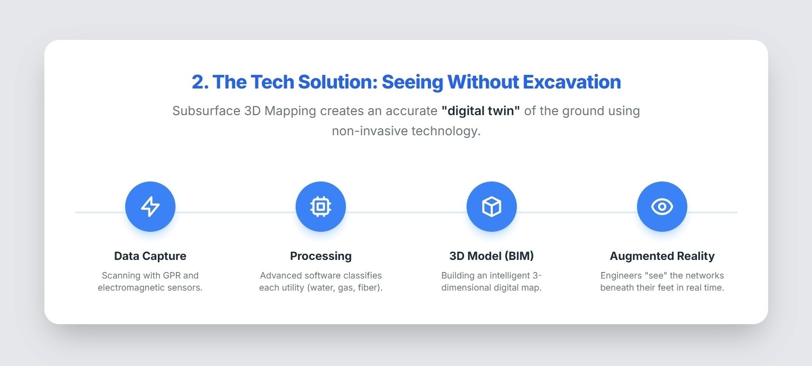
The answer to this challenge lies not in digging more test pits, but in adopting non-invasive technology that allows us to “see” underground. Companies like PCM-CLOUD MAPPING are leading this field by developing detailed 3D Underground Mapping. This approach combines multiple technologies to create a precise “digital twin” of the subsurface.
The process involves:
- Non-Invasive Data Capture: Using Ground Penetrating Radar (GPR), electromagnetism, and other geophysical technologies, the subsurface is scanned from the surface without the need to break pavement.
- Information Processing: Raw data is analyzed by expert personnel and processed with advanced software to identify the location, depth, diameter, and type of each network (water, sewer, gas, fiber optics, etc.).
- Construction of Intelligent 3D Models: Processed information is used to build a BIM (Building Information Modeling) Model. This is not just a 3D drawing, but an intelligent model where each element contains detailed information, including point cloud management above and below ground.
- Augmented Reality (AR) Visualization: These models can be taken to the field. Through a mobile device or AR glasses, engineers and workers can “see” pipes and cables superimposed on the real world, exactly where they are beneath their feet.
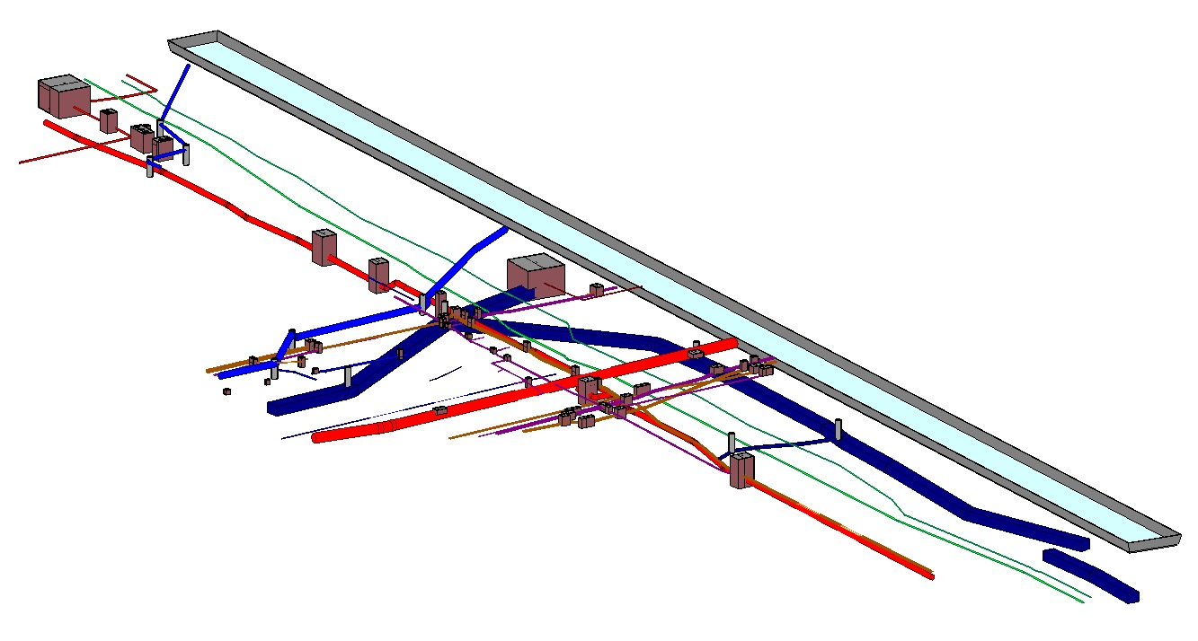
PHOTO: This precise and detailed three-dimensional model is built without relying on (often incomplete) information from utility companies, providing a complete and reliable tool for planning and executing any infrastructure project.
The Impact: The Four Pillars of Underground 3D Mapping
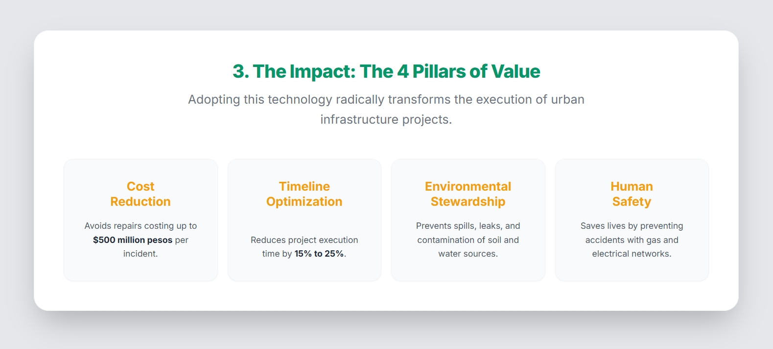
Adopting this technology generates clear and quantifiable benefits organized into four main axes, transforming how urban projects are developed.
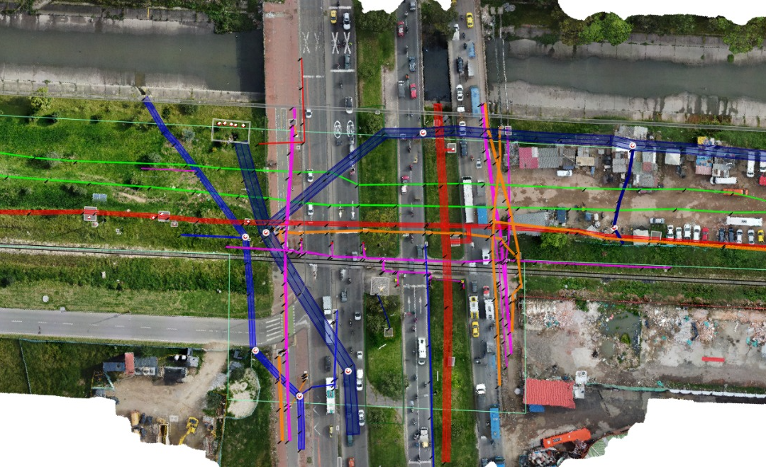
PHOTO: Real BIM Model of a Point in the city of Bogotá, with Existing Underground Infrastructure, at a scanned point with information collected without breaking roads or using invasive methods, even without total road closures.
THE PILLARS of 3D mapping:
- Radical Cost Reduction: The main advantage is economic. In Colombia, accidental damage to underground networks generates cost overruns of between 30% and 50% in projects. With prior 3D mapping, these incidents are almost completely eliminated, avoiding costly repairs that can range between $50 and $500 million Colombian pesos for each damaged network. This allows for more predictable financial closing and more efficient use of public and private resources. ¹
- Optimization of Execution Times: Time is money. Unforeseen damage can paralyze a work site for weeks or even months. By knowing the exact location of all underground infrastructure, projects can be planned and executed without interruptions. Studies indicate that having a comprehensive cadastre can reduce project execution times by between 15% and 25%, benefiting both builders and the community. ²
- Environmental Impact Mitigation: Every broken water or sewer pipe is a small-scale ecological disaster. These incidents generate spills and leaks that contaminate soil and water sources, affecting local ecosystems. The cost of environmental remediation can be enormous. 3D mapping is a proactive environmental protection tool that prevents these disasters before they occur, reducing the carbon footprint and potential polluting discharges.³
- Greater Safety for Workers: The most important risk is human. Excavating blindly endangers workers’ lives. In Colombia, approximately 30% of workplace accidents in infrastructure works are due to damage to underground networks, especially gas and electricity. Providing field teams with a precise 3D map is a fundamental safety measure that saves lives and prevents serious accidents, in addition to costs associated with compensation and medical care.⁴
¹ “Economic Impact of Damage to Underground Networks in Infrastructure Projects”, National University of Colombia, 2018. Report by the Colombian Chamber of Infrastructure, “Average Repair Costs of Public Utility Networks 2020”.
² Report “Analysis of Delays in Infrastructure Projects due to Network Damage”, National Planning Department 2019.
³ Study “Benefits of Having a Comprehensive Network Cadastre”, Colombian Society of Engineers, 2021.
⁴ Report “Environmental Remediation Costs for Underground Network Incidents”, National Authority of Environmental Licenses. Report “Workplace Accidentality in Infrastructure Works”, Ministry of Labor, 2021.
The Horizon: An Inevitable Standard for Latin America
The potential market for these services in a country like Colombia is enormous, estimated between $250 billion and $1.6 trillion pesos annually, considering that between 30% and 40% of infrastructure projects involve underground interventions.
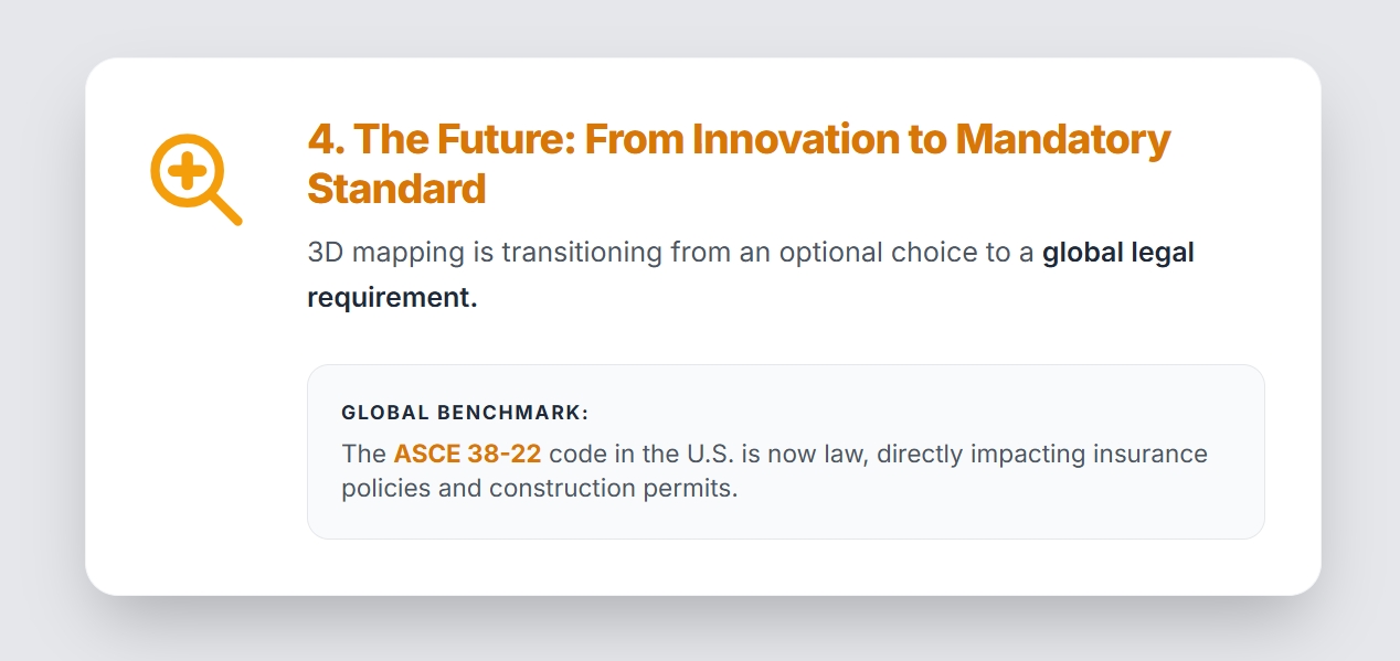
Beyond the market, adopting these technologies is becoming a global standard. In countries like the United States, compliance with the ASCE 38-22 code (American Society of Civil Engineers) is law. The adoption of methodologies such as those from BAMI-I (Buried Asset Management Institute International) represents the way forward toward developing underground Smart Cities and managing buried assets sustainably.
This standard establishes the quality of underground information that must be obtained before starting any project. Non-compliance not only invalidates insurance policies but also carries legal penalties.
It is only a matter of time before these regulations are adopted in Latin America. The need to guarantee citizen safety and efficiency in resource investment will make 3D mapping a requirement, not an option.
Conclusion: The Smart City Begins Underground
Underground infrastructure 3D mapping is not a simple innovation; it is the backbone of modern urban planning. It is the tool that allows utility companies to shield themselves against failures, designers to project with confidence, and builders to execute safely.
In a world where efficiency, sustainability, and safety are crucial, having a prior three-dimensional cadastre not only reduces costs and times but makes the difference between improvising and building with a vision of the future. The city of tomorrow is being built today, and its smartest foundations are the ones that are not seen.
PDF of Article – Smart Cities Undeground – Alberto Florez Article Feb 16 de 2026
View 3D MODEL | View 2D MODEL

About the author
Alberto Florez, Mechanical Engineer and Director of Communications for LAMS, brings 22 years of underground utility mapping experience. He led the launch of the Latin American Trenchless Technology Magazine and supports cross-regional collaboration between North and Latin America.